A federal representative visited the valley Wednesday to assess reports the city of Santa Clarita filed in regard to January storms, and to evaluate claims of damage to public infrastructure.
Any information collected is sent to the governor’s office for evaluation before being forwarded to President Trump’s office for a final decision on whether or not funding will be given to repair damages.
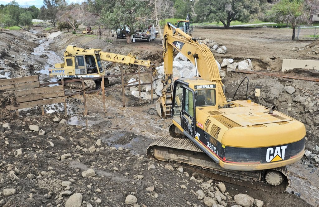
Officials viewed locations related specifically to roads, creeks and intersections. However, individual assistance for homeowners, business owners and renters will be conducted at later date.
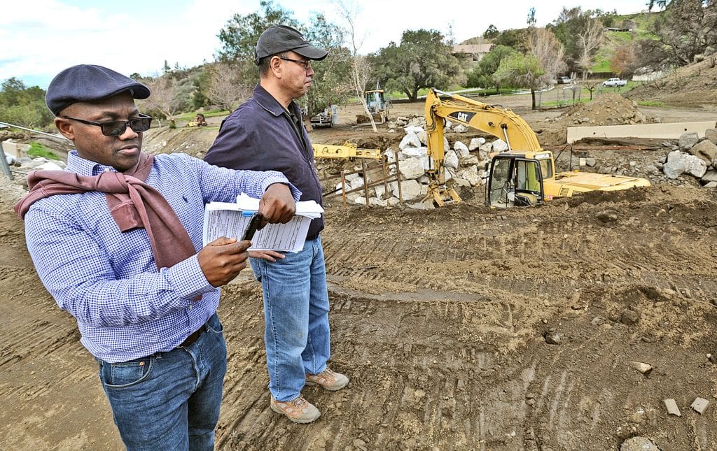
The group, comprised of a representative from local, county, state and federal emergency agencies, toured Sand Canyon Road, Iron Canyon Road, Lost Canyon Road and Camp 14 in Angeles National Forest to verify the original photographic and video reports made last month.
“I am here to work with my state partners to analyze the damage,” Federal Emergency Management Agency Project Specialist Alieu Sheriff said. “I’m validating what the state says happened over here.”
Reuben Bernaldez, California Office of Emergency Services Disaster Assistance Programs Specialist, was touring the locations for the second time after his original evaluation three weeks ago.

“Damages start at the ground level,” Bernaldez said. “We work with the local jurisdictions, gather the information, gather the data and then elevate to the proper channels until it reaches the state, then we come down to survey the damages and the sites.”
Donna Nuzzi, Santa Clarita Emergency Services Supervisor, echoed Bernaldez’s sentiment and said the damages were still a city-focused issue.
“All disasters are local,” Nuzzi said. “We have to do our due diligence to get all of this documented.”
Kenneth Kondo, L.A. County Emergency Program Manager and Public Information Officer, said much of the January and February storm damage was intensified because of the Sand fires in July and Calgrove fires in 2015.
“When we have a big fire like this, the debris and mudflow is what we’re worried about,” Kondo said. “(Without) vegetation protecting the hillsides, when the rains hit, there’s nothing to protect.”
Kondo said he encourages residents to itemize and document their damages and take photos and videos of their properties to compare with footage after a storm.
He also advised residents to prepare for future storms by developing plans, getting sand bags, preparing their contact information and gathering emergency kits.
Officials touring Santa Clarita also visited Palmdale and Agoura Hills the same day. The team was one of six groups assigned in Los Angeles County.
[email protected]
661-287-5525
On Twitter as @ginaender