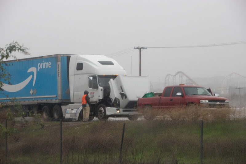
Residents of the Santa Clarita Valley were issued a flash flood warning from the National Weather Service on Monday at 3:20 p.m. and it was to be in effect until 9 p.m.
“This is a dangerous and life-threatening situation,” read the warning. “Do not attempt to travel unless you are fleeing an area subject to flooding or under an evacuation.”

The NWS said the following advice could save your life during a flood:
– Turn around, don’t drown when encountering flooded roads. Most flood
deaths occur in vehicles.
– Be aware of your surroundings and do not drive on flooded roads.
– Those living in areas prone to flooding should be prepared to take action should flooding develop or if evacuations are ordered.
– Monitor current and later forecasts
On Monday, FEMA announced that federal disaster assistance is now available for the state of California.
The announcement comes amid torrential downpour across the state that’s caused devastating floods and mudslides, particularly in Northern California but has also affected the Southland including the Santa Clarita Valley.


A Valencia High School student runs across a cross walk with an umbrella at the intersection of Dickason Drive and Smyth Drive in Valencia, Calif., on Monday, Jan. 9, 2023. Chris Torres/The Signal 

Los Angeles County Fire Department officials prepare to transport a man with a head injury near the intersection of Bouquet Canyon Road and Plum Canyon Road in Saugus, Calif., on Monday, Jan. 9, 2023. Chris Torres/The Signal
On Wednesday, Gov. Gavin Newsom proclaimed a state of emergency, which included activating the State Operations Center to its highest level. Newsom then asked President Joe Biden to declare a federal emergency — a request he obliged on Monday.
Biden’s approval of an emergency declaration authorized FEMA to “coordinate all disaster relief efforts” deemed to “alleviate the hardship and suffering caused by the emergency.”
“Specifically, FEMA is authorized to identify, mobilize and provide at its discretion, equipment and resources necessary to alleviate the impacts of the emergency,” read a statement from FEMA. “Emergency protective measures, including direct federal assistance under the public assistance program, will be provided at 75% federal funding.”


The National Weather Service was to issue a flood watch on Monday for most of Los Angeles County, which includes the Santa Clarita Valley.
The flood watch was expected to go into effect at 7 p.m. and end at 7 p.m. on Tuesday.
“Excessive runoff may result in flooding of rivers, creeks, streams, and other low-lying and flood-prone locations. Extensive street flooding and flooding of creeks and rivers are possible. Significant flash flooding is possible anywhere,” read the NWS’ advisory. “Urban areas should expect significant flooding of some roads and freeways, with major delays or closures. Excessive runoff will result in flooding of creeks and streams. While there is a chance of main stem river flooding, water flowing through normally dry rivers and washes will threaten homeless encampments.”
This was exactly what happened on Thursday, when a large storm system flooded several roads in the SCV, including Sand Canyon Road near its intersection with Roadrunner Road — where reports of a vehicle being trapped prompted a rescue response from the L.A. County Fire Department. There were no reported injuries from the incident.
The city of Santa Clarita asked residents to avoid the intersection, as well as any low bridge crossings over water. A similar advisory may also go into effect in the next two days.
The system that was expected to hit the SCV on Monday night is a Pacific storm bringing periods of widespread and heavy rainfall, which could come down at a rate of 1 inch per hour. Total rainfall is forecasted to be 2 to 5 inches in urban areas and 5 to 9 inches in the mountains and foothills.
The flood watch is also accompanied by a wind advisory, took effect at 10 a.m. on Monday morning and was expected to last until 10 p.m. Monday. Southeast winds were expected to blow at 15 to 25 mph with gusts up to 40 mph.
“Gusty winds will blow around unsecured objects and make driving difficult, especially for high-profile vehicles,” read the advisory. “Tree limbs could be blown down and a few power outages may result.”
The storm is expected to subside sometime Tuesday night.


