Another subtropical stormfront is expected to land in the Santa Clarita Valley this week, and while it’s supposed to be “a far cry” from the drenching received last week, there are reasons to keep an eye out.
Two separate weather systems could bring a total of 1 to 3 inches in the lower elevations and 3 to 5 inches in the mountains over the next five days, according to Joe Sirard, meteorologist with the National Weather Service.
There will also be wind gusts that could reach 50 mph or so, creating a potential power-outage threat from potential tree failures or stray tree limbs.
“So, we’re looking at the first storm, Wednesday through Thursday, and then the second storm, Friday night through Saturday. And we’re expecting for each storm, periods of light to moderate rain and occasionally heavy rain, especially on the south-facing slopes,” he said in a phone interview Monday.
The expected peak rain rates called for about one-quarter to a half-inch per hour for most areas, he said.
As the storms are warmer fronts coming from the south, there will be little impact on the snow-elevation levels and there may be another brief chance of thunderstorms at higher elevations, Sirard added.
“Later Saturday into Sunday, we might have a few leftover showers,” he said. “I believe early next week, Monday, Tuesday, Wednesday — we’re looking at dry weather moving back in.”
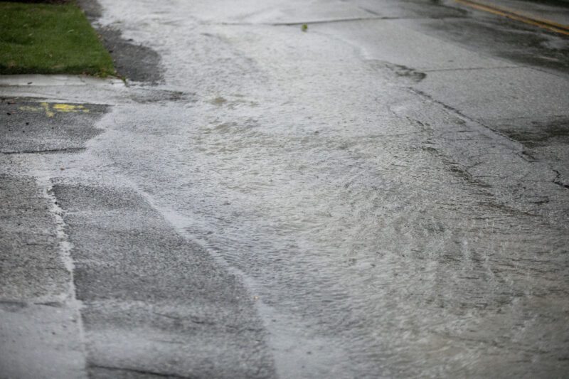
The fact that some of the areas in the storm’s path received a little over 8 inches of rain in the last week or so has given cause for concern, he said.
The ground is still pretty wet in those areas, so it will not take much to create more problems.
“So, we’re looking at the possibility of more urban flooding, roadway flooding, the possibility of some small-stream flooding and also, due to the saturated ground, an enhanced risk of additional rockslides and mud slides, which could result in road closures,” he said.
The wind gusts in the city areas are expected to reach 30 to 35 mph, Sirard said. The mountains could see gusts of up to 50 mph.