Weather officials called the approximately 1.25 inches of rain received over the weekend “the last hurrah” for January, with the forecast looking dry for the rest of the month.
However, the atmospheric rivers that have dumped more than a half-dozen inches over the past two weeks are leaving one more weather event for the Santa Clarita Valley — a cold front that’s coming Tuesday.
The National Weather Service is anticipating overnight lows from Tuesday to Friday that will approach a moderate freeze, according to an alert issued by the county’s Department of Public Health.
“The rest of January looks dry,” said Kristen Stewart, meteorologist for the National Weather Service.
“We always have — after these fronts pass through — cold air filters in from the north, and it looks like it’s going to stay there for the next several days this time around,” she added. The low temperatures for that period are expected to hover around the mid- to upper-30s, she added.

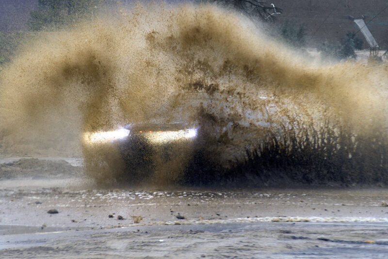
While storms that have buffeted the state up and down its coast have created flood conditions in parts of the SCV where the burn scars from incidents like the Lake Fire linger, they’ve also helped ease the drought conditions the state has been in for several years and helped to replenish California’s snowpack.
Stewart noted the records indicate the SCV has received significantly different rainfall totals depending on where one lives — the Newhall observation station reported more than 10 inches over the past 14 days and in Saugus that total reads at 5.44 inches since Jan. 1.
Saugus has received almost 8.5 inches since Oct. 1, which is almost a half-inch more than what the same station recorded for the entire previous rain year (8.1 inches), which climatologists track from Oct. 1 to Sept. 30.
This has meant good news for the state’s reservoirs, which have benefited to different degrees from the recent downpours.

Castaic Lake is currently around 52% of its capacity, according to the most recent figures from the state’s Department of Water Resources, which is 67% of its historical average.
DWR data also shows how the rains have alleviated the drought’s impact on the Sierra snowpack, which supplies about 30% of California’s water needs.
In January 2021, the state’s snowpack was 26% of the average for April 1, which is considered the end of the snow season, and 51% of normal. The current levels for the Northern Sierra snowpack, for example, read at 100% of the annual total, and 209% for the normal reading this time of year.
However, hydrologists expressed little more than cautious optimism at the early good news, noting that in December 2021, the state also saw significant precipitation, but it was followed by the driest January to March on record, which provided little relief for the state’s reservoirs.
“Big snow totals are always welcome, but we still have a long way to go before the critical April 1 total,” said Sean de Guzman, manager of the DWR’s Snow Surveys and Water Supply Forecasting Unit. “It’s always great to be above average this early in the season, but we must be resilient and remember what happened last year. If January through March of 2023 turn out to be similar to last year, we would still end the water year in severe drought with only half of an average year’s snowpack.”