The last time the region saw rain like this in August, “Gone with the Wind” was a big box office draw and Mattel was about two decades away from bringing Barbie to market.
In fact, the National Weather Service didn’t even have a Los Angeles office, according to NWS meteorologist David Sweet.
“There was an unnamed tropical storm that moved into Long Beach,” Sweet said in a phone interview Monday, referring to a 1939 incident that was the last time a tropical storm touched down in Southern California — similar to the one that dumped more than 5 inches of rain in a 24-hour period that started Sunday.
“There were some deaths on the ocean and some deaths on land,” he said, putting the death toll at around 100 for the 1939 storm and adding the casualties were a contributing factor in the NWS decision to build a Los Angeles office for its national network of stations.
The nearest one at the time was San Francisco.
“Of course, back then we didn’t have satellite pictures, so there was no way to see this storm coming,” he added.
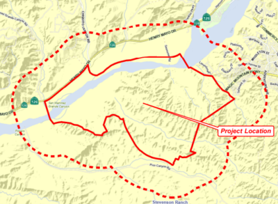
Tropical Storm Hilary moved inland from the south and then almost directly north toward the Santa Clarita Valley over the weekend.
Now meteorologists are able to see on a Doppler weather radar that the storm had largely dissipated as of Monday evening, with resulting scattered showers in Nevada and all the way to the Eastern Washington area.
This was actually the second time a tropical storm has come close to the area this season. Ernesto moved up Baja, California, during the second week of August and left a bit of precipitation in the air, too, during a normally dry time.
However, meteorologist Joe Sirard said Monday that he wouldn’t count on a three-peat.
“I would say there’s an extremely small chance we’ll get another — highly unlikely,” he said, adding it’s not impossible since the tropical storm season continues until November, but then for emphasis added, “it’s highly likely we’ll not see another one of these for many years based on climatology.”
The downpour that started Sunday in the SCV resulted in 5.71 inches in a 24-hour period. The state and county declared a state of emergency for Southern California, with the L.A. County Board of Supervisors expected to discuss the aftermath at 9 a.m. Tuesday with its single-item special meeting agenda.
The agenda asks the Board of Supervisors to formally ratify the call by Supervisor Janice Hahn, current chair of the board, over the weekend.
“I also signed a declaration of local emergency (Sunday). That means that we have activated the full extent of emergency powers to protect life and property,” Hahn wrote in a statement over the weekend. “Critically, it also means that we are signaling to state and federal agencies that L.A. County is ready to accept any assistance they can give.”
From all accounts Monday morning, the devastation over the weekend paled in comparison to the last time a hurricane-like force bore down on the SCV. The most significant reported damage to the area after the storm was a collapse of the shoulder on Sand Canyon Road near its intersection with Soledad Canyon Road. No major injuries or deaths were attributed to the storm as of this story’s publication.
In its wake, Hilary’s rainfall pushed the Newhall Pass’ recorded rainfall total close to its record, but not quite.
While NWS officials don’t keep exact totals for the city of Santa Clarita, due to it not having an official collection point here, Sweet said there is unofficial data from the state’s water website, which records precipitation in the past.
The highest level for the Newhall Pass referenced in the archives was the 1977-78 water season, when the pass recorded 44.66 inches in the water year, which ends Oct. 1, according to a 1998 report in The Signal.
The 5.71 inches recorded since the start of the current storm pushes the total for the year at that point to 44.19 inches. Hydrologists count the water year from Oct. 1 to Sept. 30.
While the rain put significant stress on the roads and local first responders dealt with a much higher volume of rain-related calls than normal for August this past weekend, it did provide continued relief from the state’s yearslong drought.
For reference, at this point in 2022, the annual rainfall total was 14.88 inches, which is in line with historical averages for the region. In 2021, it was a dry 5.39 inches, and in 2020, it was 18.77 inches.
California’s water watch put the total at 187% of the average amount of rain the area receives for the year. SCV Water, the area’s local water retailer and wholesaler, announced the area was not under the governance of a drought contingency plan in July.