A mother still grieving from the loss of her son in a San Francisquito Canyon Road crash that killed five nearly three years ago brought her concerns to Santa Clarita City Hall last week, after a recent tragedy offered a reminder of his death.
She’s certainly not alone.
There have been 18 deaths on that road since 2013, with speed being the predominant factor on a road where data indicates head-on collisions are the most common type of incident, according to county and state officials who’ve been studying the road’s problems for years.
L.A. County officials are responsible for San Francisquito from north of Lowridge Place past city limits to Lake Elizabeth Road. In response to recent questions about the deaths, they cited millions being spent on planning and improvements for the 19-mile stretch that runs from Copper Hill Drive to Green Valley.
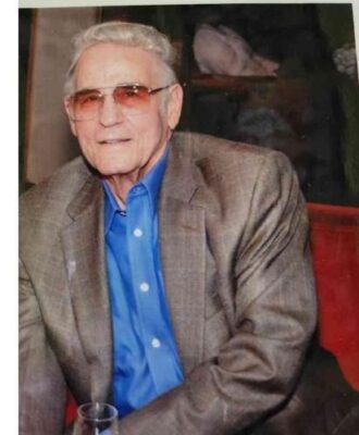
But Gabriela Thomas, who lost her son, Spencer Thomas, in an Aug. 28, 2022, crash, told the city the work isn’t happening fast enough and asked for council members’ help to get it done.
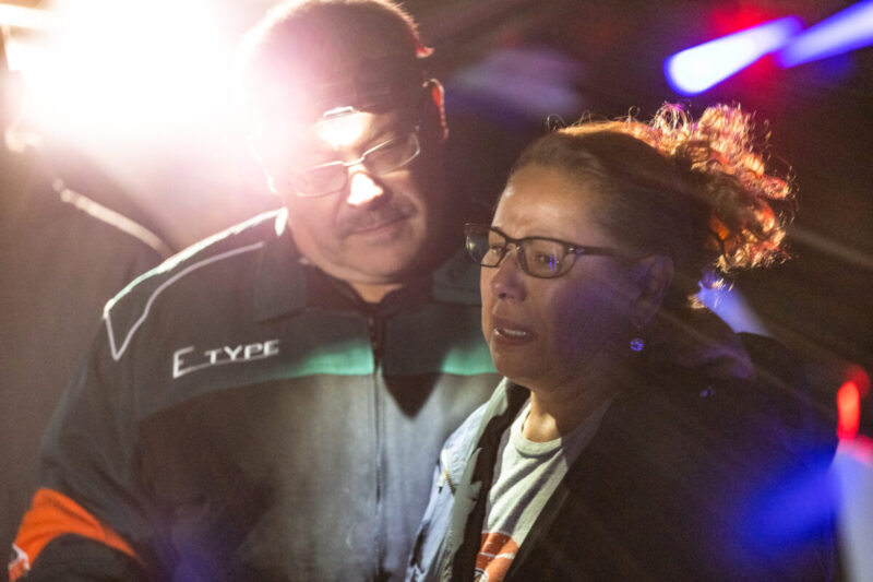
“It was the unthinkable, unimaginable and unbearable — a parent’s worst nightmare. But somehow here I am three years later, here I am, standing before you, asking for your support,” Thomas said, after another recent crash left one more dead and two others seriously injured.
Thomas also asked for the city’s support for a memorial garden that could help raise awareness of the road’s tragic past and its dangers.
The danger
At parts, San Francisquito Canyon Road is filled with more blind turns than allowable passing space as it winds through canyons north of the city.
Thomas was asking the city to put its voice behind her concerns for a stretch outside city limits that has seen nine deaths since 2020, according to the California Highway Patrol.
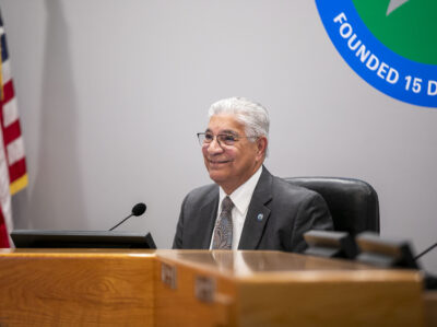
Santa Clarita City Councilwoman Patsy Ayala asked City Manager Ken Striplin about the street during the meeting. Striplin said he did not have all the data available, but his understanding was that the crashes have happened outside city limits, and the city only controls “a very small segment.”
L.A. County has been working on the Corridor Traffic Safety Study for San Francisquito Canyon Road since August 2024, according to a May 30 email from Kerjon Lee, spokesman for county Public Works.
The safety plan identified five stretches spread out over four maps that also identify speed on the winding road as the main factor in most of the collisions.
The safety plan specifically mentions the danger of head-on collisions, which claimed the life of a sheriff’s deputy driving home from work a few weeks ago. It happened in one of the county’s three identified “collision concentration corridors.”
Those are identified in the report to the L.A. County Board of Supervisors as: 1 mile south of Stator Lane to 1.5 miles south of Stator Lane; 0.75 mile north of Stator Lane to 1.25 miles north of Stator Lane; and Elizabeth Lake Road to 0.5 mile south of Elizabeth Lake Road.

Latest casualty
On May 19, Deputy Daniel Chavira was the latest name to join the list of those who have died in crashes on San Francisquito Canyon Road, when his vehicle crossed over into oncoming traffic just north of the fire camp located off Stator Lane.
Chavira, a 21-year-old who was days away from being transferred to the Palmdale Sheriff’s Station much closer to his home, reportedly fell asleep behind the wheel and crashed. He was heading home after a 16-hour double shift, according to a source in the L.A. County Sheriff’s Department, when he crossed the lines and crashed head-on into another vehicle.
A look at the data from the California Highway Patrol, which the county prepared ahead of its safety study, demonstrates Chavira’s crash was far from an anomaly for San Francisquito.
“(L.A. County) Public Works reviewed traffic collision data provided by the CHP from Jan. 1, 2013, to November 2023 to evaluate traffic collision trends in San Francisquito Canyon Road,” according to the county study, which indicated there was an average of more than one per week over a 565-week period.
“During this evaluation period there were 589 collisions reported to CHP, 62 of which were categorized as fatal or severe injury collisions, resulting in a total of 18 fatalities,” per the county’s report.

Facing the head-on danger
Fifth District Supervisor Kathryn Barger initiated the recent work with a motion directing a comprehensive traffic study in 2023.
The study that came back in 2024, conducted in collaboration with the CHP and other community partners, is part of a larger effort to develop a robust Community Traffic Safety Plan, Lee wrote in an email.
“As part of the study, L.A. County Public Works will monitor the performance of the road delineators over a six-month period to determine their effectiveness and resilience through the next storm season,” Lee wrote, noting the work has started near the Grass Valley portion, which is also going to solicit community input from residents.
“The road delineators are reflective, flexible devices that stand approximately 3 feet tall and are mounted in the center of the roadway to provide greater visibility of the centerline and prevent drivers from crossing over into oncoming traffic,” according to Lee. They’re meant to reduce traffic incidents and improve overall roadway safety for commuters.
“Unsafe speed and improper turning were identified by CHP as primary factors for the majority of all collisions,” according to the county’s report. “Collisions involving fixed objects accounted for one-half of all collisions, as well as one-half of all severe injury collisions,” per the county’s report. “Additionally, nearly half of all incidences resulting in fatalities involved head-on collisions.”

Chavira, who was airlifted to Henry Mayo Newhall Hospital, ultimately died from injuries he sustained in the crash, which resulted in four patients being treated for injuries, including two patients who were under the age of 18.
The whole incident brought back seemingly still-fresh wounds for Gabriela Thomas, a 30-year resident whose son “was on a leisurely scenic drive with his 27-year-old girlfriend on a beautiful Sunday afternoon, traveling within the speed limit, when a white BMW came out of nowhere,” she told the council during public comment on May 27.
A witness who asked to remain anonymous told The Signal shortly after the 2022 crash that she was driving behind Spencer Thomas’ blue 1989 GMC Suburban, going about 10 mph slower than the posted 55 mph speed limit on the curvy road, when the sedan “comes probably at about 90 mph straight into the pickup truck.”
The collision resulted in Thomas, 28, and the BMW’s driver, 40-year-old Wilber Montenegro, of Valencia, being killed instantly, as well as two passengers in his car: 41-year-old Shane Rivera, of Glendale; and 41-year-old Eugene Segura.
The witness stated the BMW didn’t even have a chance to swerve before it smashed head-on into the pickup truck Thomas was driving, near the entrance to Rosewood Equestrian Center, about a half-mile south from where a bouquet of flowers stood Friday in a roadside memorial for Chavira.

‘Forthcoming improvements’
Thomas’ collision was only eight months after another fatal traffic collision that resulted in the deaths of four others on the same road in late August 2021, according to previous reports.
The county’s safety study also notes that addressing speed with the CHP and other community partners will be a factor in reducing the number of crashes going forward.
Lee said the corridor study was developed in close collaboration with the local community, and that in addition to the delineator project in August, the Board of Supervisors authorized the reduction of speed limits along five sections of roadway in January.
Another upcoming project to install chevron signs and curve advance warning signs along San Francisquito Canyon Road from Elizabeth Lake Road to the Santa Clarita border “is funded and ready to move forward early next year,” according to a text from Lee, who added that many of the other projects identified in the corridor study are still in design.
“I support the forthcoming safety improvements to San Francisquito Canyon Road, which — thanks to the community’s input — has been identified as a high-risk corridor for unsafe passing. Installing delineators along the curve and other road improvements that have been implemented and are currently being analyzed for efficacy are smart steps forward,” Barger wrote in an email sent by Helen Chavez, her director of communications. “I’m committed to ensuring that Public Works prioritizes this project with both urgency and precision. Striking the right balance between moving quickly and conducting a careful, science-based assessment is essential to making lasting and effective safety enhancements.”