Since Hurricane Harvey made landfall Friday, more than 50 inches of rain has been dumped on parts of southeastern Texas.
It would take half a decade for that much rainfall to accumulate in Santa Clarita.
The unprecedented rainfall from Hurricane Harvey also set a preliminary record for the greatest amount of measured single-storm rainfall for the continental United States, according to the National Weather Service (NWS).
A previous record for Texas was set in 1978 when tropical cyclone Amelia dropped 48 inches of rain on Medina, Texas.
For California, a storm of this magnitude does not seem likely, as it would take five water years—measured from Oct. 1 to Sept. 30—to reach the rainfall totals set by Hurricane Harvey.
In Santa Clarita, according to five-year water totals from the Newhall Station from Oct. 1, 2011 to Sept. 30, 2016, it would take a total of 1,825 days for the area to receive more than 50 inches of rainfall.
The storm that first hit Texas also dropped 19 trillion gallons of water, or about 72 trillion liters of rain, on Texas alone, according to a Wednesday report from the Washington Post.
This number is staggering when comparing it to the capacity of an Olympic-sized swimming pool or Santa Clarita’s lakes.
The rainfall from Harvey in Texas alone was enough to fill 28 million Olympic-sized pools to the brim, with each pool holding 660,430 gallons of water.
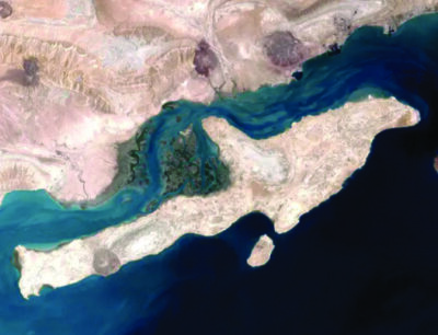
Santa Clarita’s own Castaic Lake has a capacity of 325,000 acre-feet, or nearly 106 billion gallons of water. The week’s deluge was enough to fill the lake’s capacity 179 times.
And at Pyramid Lake, with a capacity of 180,000 acre-feet or approximately 58 billion gallons, rainfall from Harvey could fill its capacity 323 times.
Santa Clarita Effect
Santa Clarita has seen its own fair share of flooding and mudflows this year.
On Feb. 17, “one of the strongest storms of the past six years” hit Southern California and brought up to six inches of rain to areas of the valley.
This storm alone closed down streets and flooded roadways in the Sand Canyon, Placerita Canyon, Hasley Canyon Road and Del Valle neighborhoods, and sent mudflows across Sand Canyon Road.
A smaller storm earlier in the month, on Feb. 6, brought 0.83 inches of rain to Newhall and Del Valle and still created flooding on Del Valle Road and Hasley Canyon Road.
So, it begs the question – what would happen to Santa Clarita in a storm the size of Harvey?
Flood control district
In 1915, Los Angeles County created its Flood Control District after a series of large scale flooding incidents, according to Kerjon Lee, public affairs manager for Los Angeles County Department of Public Works.
“The infrastructure now exists largely in the L.A. Basin and through storm drains and structures in cities like the Santa Clarita Valley,” Lee said. “Those are largely designed by the Army Corps of Engineers and L.A. County Public Works.”
Developed areas, like the city of Santa Clarita, have a storm drain networks that are connected to this larger county system; however, the system is only designed to handle a certain level of a flood event, like a 100-year flood event, according to Lee.
A “Harvey” would be a little too daunting.
“What you had in Harvey was something in the magnitude of a 400-year storm, with a one percent chance each year over 400 years,” Lee said. “It is a really massive amount of floodwater… the system that we have in L.A. County is not designed to handle that kind of event, it would be a major engineering challenge.”
However, Lee noted that the unique topography of Los Angeles County could allow for water drainage that is not currently happening in Houston.
“Much of the Basin still allows for drainage especially in the Santa Clarita Valley,” he said. “Whereas in Houston, where you have large areas of flat land, the water just stays so that is challenge for that community… As an agency directly involved in this sort of work, it personally is really difficult to witness that happening.”
Residents, however, most likely recall when year a portion of Soledad Canyon Road washed out, and in the late 90s when Bouquet Canyon Road bridge failed as torrential downpours and fast moving Santa Clara River waters undermined the bridge’s support.
If a major flood event were to hit the SCV, Lee said the Department of Public Works would speak to residents before and after the storm to encourage them to design their properties according to their flood risk and evaluate their individual risk as each storm strikes.
“There’s that public component of it for the public to know they need to prepare for the emergency,” Lee said.
The department also participates in emergency planning between agencies at the local, county and state level to respond together.
“While those emergency incidents are localized, much of the coordination is the same where we will be messaging out to the public to evacuate and identify areas where they can shelter and be reunited with their families,” Lee said.
[email protected]
661-287-5575
On Twitter as @_ChristinaCox_