
Flood warnings issued, evacuations possible near Canyon Fire burn scar
The National Weather Service is predicting an inch and a half to 2 and a half inches of rain Thursday, a downpour that’s fast and strong enough to prompt flood warnings from emergency responders and evacuation warnings for residents near the Canyon Fire burn scar.
On Wednesday, the Santa Clarita Valley Sheriff’s Station warned residents about potentially hazardous conditions, including flooded roadways, mud and debris flows and downed trees or power lines.
The weather service is predicting several storms over the next two weeks, according to Mike Wofford, meteorologist for the National Weather Service. However, the most intense weather is expected to start early Thursday.
“Probably 4 a.m., 5 a.m. starting, with the heaviest rain between 8 a.m. and 4 p.m. … somewhere in that range, basically during the daytime hours,” Wofford said, with up to an inch per hour possible in the SCV’s higher altitudes during the strongest part of the storm.
“So that would trigger some possibilities for some at least minor debris flows in those burned areas, and possibly some larger ones, depending on exactly how much falls in those areas … obviously lots of water on the roads and dangerous driving conditions and all that, and thunderstorms will be coming through again.”
Castaic residents shared a warning they received on social media about the need to be prepared for a possible evacuation.
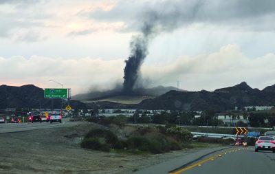
The evacuation warning was targeted toward homes in the vicinity of the Canyon Fire burn scar, referring to the Aug. 7 incident that burned about 5,370 acres over the course of seven days, according to the Cal Fire website.
“Get ready for possible evacuations if you are near Hasley Canyon, Castaic and Val Verde. Gather loved ones, pets and supplies. Those who need more time evacuating should consider leaving now,” according to the alert, which referenced an area “bounded east of Mount Parkway Fire Road, south of Hasley Canyon Road and west of Wolcott Way.”
The thunderstorms could come in during the mid-morning or mid-afternoon times, when the rain is heaviest, he added.
The SCV Sheriff’s Station alert mentions the current El Niño weather pattern, which has dropped 1.76 inches of rain since Oct. 1, according to a recording station in the Newhall Pass. The L.A. Almanac indicates that’s about double what the meter usually reads this time of year based on historical averages.
“While we can’t predict exactly what this storm season will bring, we can take steps now to be prepared,” Capt. Brandon Barclay wrote in an SCV Sheriff’s Station statement Wednesday. “I encourage all residents to have an emergency kit ready, know their evacuation zone, and make sure they’re signed up to receive important safety alerts.”
As part of that preparation, the station is hosting a sandbag giveaway from noon to 3 p.m. Sunday at Central Park.
During the giveaway, residents will be able to receive up to 25 pre-filled sandbags per vehicle, with empty sandbags also available. Distribution is being done on a first-come, first-served basis while supplies last, according to station officials.
Residents with a smartphone or home internet access can view evacuation warnings and orders through the Genasys Protect app or at protect.genasys.com.